The Evan-Moor company has become one of my favorites over the past couple of years. Even though they don’t write curriculum specific to homeschoolers, I’ve found that much of their material is suitable for those of us who teach at home. One of my most recent Evan-Moor treasures is called The World Reference Maps and Forms. Why do I love this so much? Being a mom who enjoys designing her own lessons, this book provides me with 92 maps covering the entire world that I can find and copy at a moment’s notice!

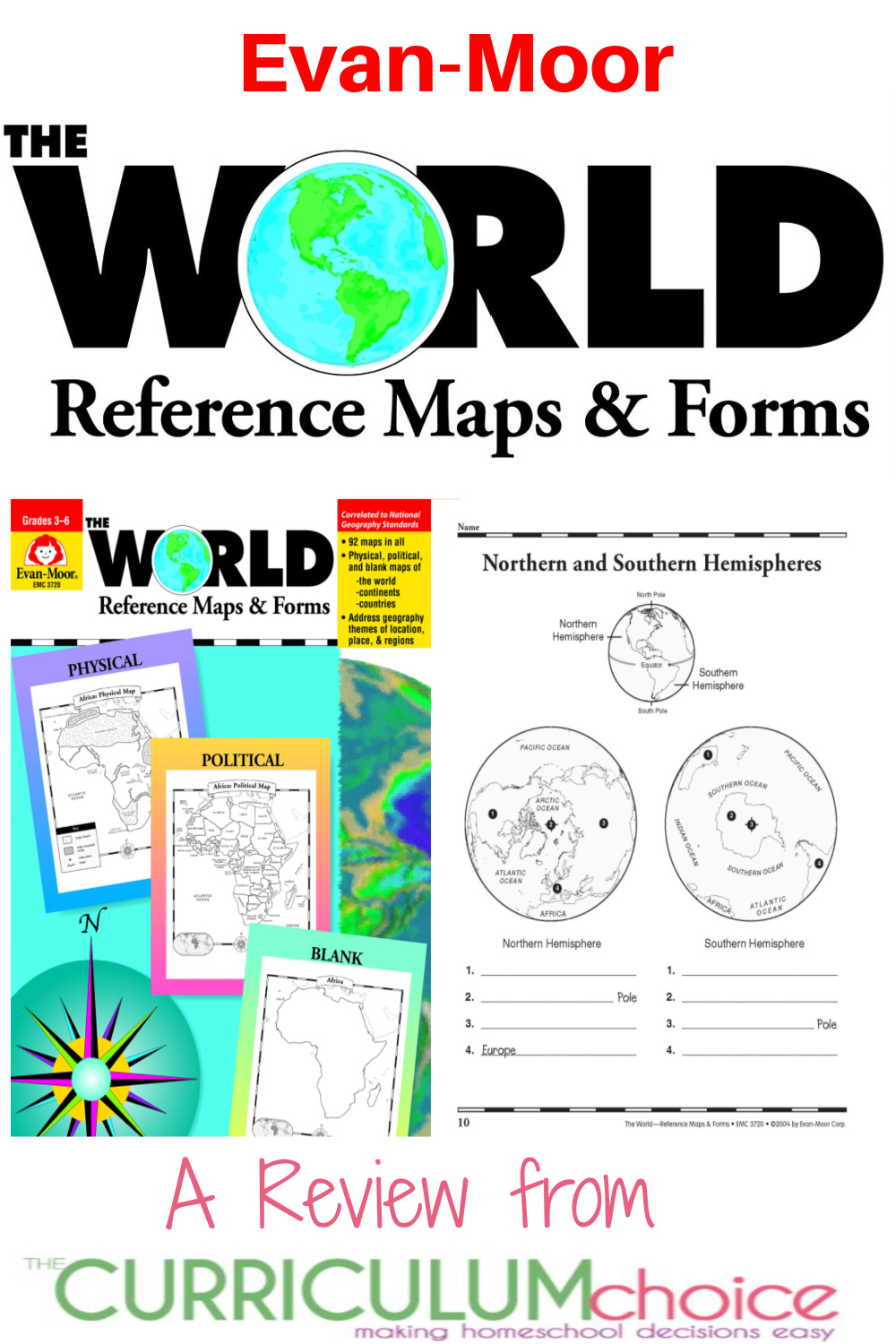
Evan-Moor The World Reference Maps and Forms
The World Reference Maps & Forms contains 92 maps, evaluation forms, a crossword puzzle, a word search, and an answer key.
A Look Inside Evan-Moor The World Reference Maps and Forms
The first section, The World, includes:
- an introduction of general facts about the world
- a list of 192 countries in the world
- a reference political map of the continents
- a blank world map
- Robinson and Mercator projection maps
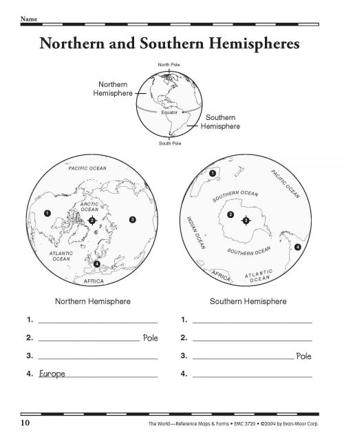
- globes, showing hemispheres, parallels, and meridians
- maps of oceans, rivers, mountain ranges, and deserts
The second section, The Continents, includes:
North America:
- an introduction, listing the countries, area, population, elevations, and fun facts about the continent
- reference political and physical maps of North America, Canada, the United States, and Mexico
- blank outline maps of North America, Canada, the United States, and Mexico—shape, political, and physical
- study maps of each region of the United States and Mexico and the provinces and territories of Canada
- a reference map of six regions of the United States
- study maps of Central America, the Greater Antilles, and a reference map of the Lesser Antilles
- an introduction, listing the area, elevations, and fun facts about the continent
- a reference political map and physical map of South America and Northern South America
- blank outline maps of the continent–shape, political, and physical
Africa, Europe, Asia, and Australia
- an introduction, listing the countries, area, population, elevations, and fun facts about the continent
- a reference political and a physical map of the continent (a political map of Oceania is included with Australia)
- blank outline maps of the continent—shape, political, and physical
- study maps of regions of the continent
Antarctica and the Arctic Region
- an introduction, listing the area, elevations, and fun facts about the continent
- reference polar projection maps of Antarctica and the Arctic Region
- a reference map of the scientific stations in Antarctica
- blank outline projection maps of Antarctica and the Arctic Region
Maps are included of all seven continents, with North America getting some extra special attention on each of its countries. For each section you will find a labeled and unlabeled political map and physical map, as well as a blank map. There are also maps that break the continents (and North American countries) into regions.
Many of the maps include places for a child to label things like countries, rivers and oceans, while other maps are just plain old maps. In other words, you can choose between a map that is already labeled for the child to color certain areas, a blank map that the child must label themselves, or a map with a specific exercise in labeling.
Before each continent’s maps, there is an introduction page giving all sorts of information about the continent. All the countries are listed in alphabetical order telling you the exact number of countries that can be found there. A small section of facts about area, population, elevation and a few other tidbits are given as well.
Also included is a section on the world where you’ll find maps teaching hemispheres, latitude and longitude, Robinson Projection, oceans, and more.
What do the maps look like?
Each page is uncluttered in black and grey print on white paper. A simple border goes around all the maps for visual interest and a small world or country map is included with all focused maps to help you see where the particular area fits in “the big picture”. For example, if you are working on an activity about West Africa, there will be a small map of the entire continent of Africa with West Africa shaded in. This helps you to know where in the world you are.
Simple keys and/or a compass rose are included when necessary. All the maps are clearly labeled at the top, so no one is ever confused about what is in front of them. For instance, a map of Russia will say, “Northern Asia: Russia”.
Besides maps, in the back of the book you will find a “Continent in Review” form which can be used for any continent as a mini-report. To review some geographical terms, a crossword puzzle and word search are included, too.
What’s my final conclusion?
If you choose to work through the book map by map, your child will gain a vast amount of knowledge about mapping, the world, and its places. If you choose to only use the book as a reference to copy particular maps when you need them (as I do), your children will be greeted with a very clear map that will be a great addition to your particular lesson. In this case, although the book is recommended for 3rd through 6th grades, I think the maps could be used for a much wider age range.
Purchase Evan-Moor The World Reference Maps and Forms
You can choose either a printed copy or an e-book version for $18.99, which I believe to be a very fair price. To see for yourself, I encourage you to visit the Evan-Moor Website to see sample pages and purchase the book.
You can also purchase the print copy at Amazon.
Visit www.evan-moor.com to find other great resources for your homeschool.
More Geography Resources
- Geography Songs – Sing Around the World
- World Geography with North Star Geography
- Homeschool History and Geography Reviews from The Curriculum Choice
- Geography Adventures for Kids: An Adventurous Mailbox Review
- Favorite World Geography Games
MORE EVAN-MOOR BOOK REVIEWS FROM THE CURRICULUM CHOICE
- Habitats Study
- Evan-Moor Science Series – All About Plants
- History Pockets I & History Pockets II
- Spelling Skills & Building Spelling Skills
- Daily Word Problems
- ScienceWorks for Kids Series I & ScienceWords for Kids II
- Hands-On Elementary Science – ScienceWorks Book – Energy
- Daily Paragraph Editing
- Early Math – Geometric Shapes and Fractions
- Design a Poetry Unit with Read and Understand Poetry
- Sequencing Simple Stories
Originally Published May 2009 by Cindy West, a Charlotte Mason, Classical, Unit Study inspired of mom of three from KY. You can also find her at Our Journey Westward.

Thanks for this review. This ebook looks like something we could really use. I’ve added it to my wish list. 🙂
Thanks for a great review! I am putting this on our wish list for next year!
You’re welcome! :o)