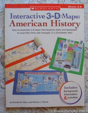
 One of our investments for the 2011 school year was Scholastic’s Interactive 3D Maps: American History. It was actually recommended by the core programme we are using, but the book itself was bound to be a hit with two map loving young boys. Not to mention they really enjoy doing hands-on projects, so mixing the two together sounded like it would be right up their alley!
We were not in the slightest bit disappointed with this book! We are just under halfway through the book and have mapped the adventures of Various Explorers, The Mayflower, Paul Revere, The Slave Trade, Lewis & Clark and a few more. Which is nothing compared to what’s left waiting for us in the book!
The Breakdown:
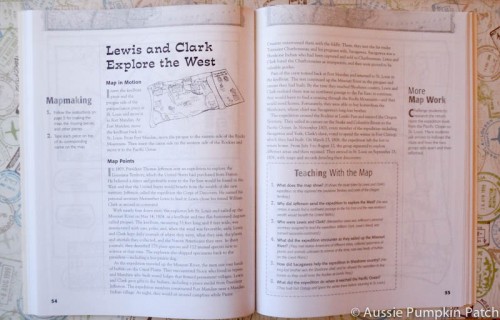
Each map has a total of four pages. Two pages are written more to the teacher and provide information about the map, time period, and/or event that took place. It also provides instructions of how to put the maps together and a few ideas to use the maps as well.
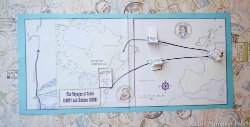
The next two pages are the actual map and pieces that go with it. So for instance, with Lewis & Clark you’ll have two pieces of map, various forts, Indian villages and boats. The children colour the maps and pieces and then assemble everything together.
How We Use It:
I find that my children love to color when I’m reading aloud to them. So these maps are often colored while I’m reading about the people or times involved in these maps! Once colored we cut the maps out.
The instructions state you are to glue the maps on construction paper, but we like to do things just a wee bit different. Instead, we tape both pieces of the map together, then we take two pieces of colored card stock and glue the map to both pieces leaving about an eighth of an inch gap between the two pieces. Why?
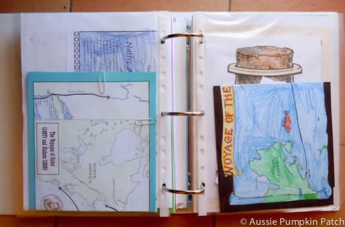
This allows us to fold the map neatly, paperclip all the accessories to the map & tuck it into a nifty page protector {I love those things!} before we put the whole thing right into the kids timeline notebook. Easy Peasy!
What I Love:
This book is fantastic and my kids love the maps! I love that they love the maps and can visualize all the things we’re reading about. I love that the little pieces can be moved around the map and places on specific locations like the starting and stopping point of journeys.
The price: This book is extremely inexpensive when you consider that it is reproducible. The book ranges in price from $10.99 {amazon.com} $11.99 {Book Depository with free shipping}, or $15.99 {directly from Scholastic as an ebook}. Either way you go, it’s a great deal.
What I don’t Love:
There is one thing I don’t love about this book, and really only one thing. The pages aren’t perforated and the book isn’t spiral bound. It makes copying the pages a bit more difficult, but not impossible! However, the lack of either of these does not stop me from loving this book! It really isn’t that big of a deal to copy it like it is. Of course if you purchase this book directly from Scholastic as an ebook that’s not an issue you’d have to worry about!
Bottom Line:
We love the book and I’m extremely happy with the purchase! My kids are very hands-on and love being involved in their projects. These maps are simple enough that even my eight-year-old can do most of it without assistance.

This is a wonderful review simply because now I want it lol!! We love Scholastic books so Im sure this one is just as wonderful!! Thanks so much!!!